Introducing Carto: A New AI Tool for the Dutch Caribbean
This article originally appeared on the online news platform (BIO)NEWS
The Dutch Caribbean Nature Alliance (DCNA) is proud to be involved in the development of Carto, an innovative web application designed to modernize how we monitor and protect key habitats across the Dutch Caribbean. This tool, partly funded by DCNA and developed by Spheer, allows users to use satellite imagery and artificial intelligence to create custom maps for monitoring and managing habitat areas.
What is Carto?
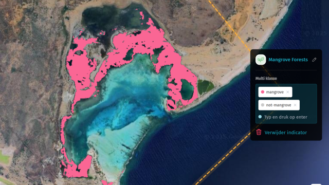
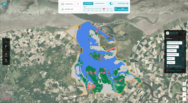
Carto is an AI-powered monitoring tool that combines artificial intelligence and satellite imagery to create real-time, accurate monitoring of both land and water ecosystems. With Carto, users can create their own monitoring applications, train AI models, and generate predictive maps for a variety of ecological indicators. Whether it’s tracking biodiversity, managing natural resources, or observing habitat changes, Carto offers an unprecedented level of precision and scalability, able to cover the entire Caribbean region with just a few clicks.
One of the most exciting features of Carto is its accessibility. Users only need to provide a few sample data points to generate highly accurate maps and trends. From mangrove forests to seagrass meadows, from invasive species to sargassum blooms, Carto can be tailored to monitor a wide range of indicators.

Pilot testing
During Carto’s alpha phase, DCNA’s Network partners from the five islands—Bonaire, Curaçao, Saba, Sint Maarten, and Sint Eustatius—will actively participate in testing this new tool. Even though Aruba isn’t actively participating, the island is still included in Carto, giving the opportunity to test scalability and accuracy on the island. Each island will train AI models to monitor specific indicators, such as mangroves, invasive species, and seagrass. The initial list of indicators—mangroves, invasive species, seagrass, and sargassum—is just the beginning. One of Carto’s strengths is that it allows users to train models on any number of ecological indicators, offering a fully customizable experience for conservationists, researchers, and policymakers.
"We encourage anyone involved in nature conservation, environmental management, or research to explore Carto's capabilities and consider how it can support your work."
A New Tool to Boost Caribbean Habitat Protection Efforts
DCNA is excited to explore and help develop this tool for the new Conservation and Restoration of Key Habitats program to identify and address challenges across the Dutch Caribbean. By bringing this level of precision to habitat monitoring, DCNA is empowering local stakeholders and international partners to better protect the ecosystems that are vital to the Caribbean’s environmental and economic health.
For those interested in learning more about Carto, there is a brief, one-minute demonstration video (see below), as well as an in-depth tutorial available with subtitles. We encourage anyone involved in nature conservation, environmental management, or research to explore Carto’s capabilities and consider how it can support your work.

DCNA
The Dutch Caribbean Nature Alliance (DCNA) supports (science) communication and outreach in the Dutch Caribbean region by making nature related scientific information more widely available through amongst others the Dutch Caribbean Biodiversity Database, DCNA’s news platform BioNews and through the press. This article contains the results from several (scientific) projects but the projects themselves are not DCNA projects. No rights can be derived from the content. DCNA is not liable for the content and the in(direct) impacts resulting from publishing this article.


