This article originally appeared on the website of Samenwerkingsverband Noord-Nederland on 8 may 2025.
"Carto" used to be the name of the "Spheer App".
What if anyone dealing with a spatial challenge – from conservationist to policymaker – could analyze a nature area within minutes using AI? That’s the mission of Spheer.ai. With their innovative platform Carto, supported by the European Just Transition Fund (JTF), they’re accelerating a process that used to take weeks or even months.
The earth is constantly changing. Climate change, biodiversity loss, urbanization – they’re all global issues with a spatial component. “Much of what humans do affects the earth’s surface,” says Jakko de Jong, co-founder of the Groningen-based SME Spheer.ai. “And if we don’t properly understand what that impact is, we can’t respond to it effectively either.”
Satellites have been capturing images of the earth since the 1950s. Today, the amount of available data is enormous. And that abundance is precisely the opportunity – if you know how to use it. That’s where artificial intelligence (AI) comes in.
From fieldwork to virtual insight: How AI can transform nature monitoring
Until now, nature analysis and monitoring have largely been done manually – fieldwork by specialized ecologists. This approach is time-consuming and costly. Even though an abundance of satellite data is available, it remains underused and often inefficiently deployed. The few AI models in use often require retraining for every new use-case. This slows down the very decision-makers who depend on those insights. “Training an AI model on this data is complex and expensive. You need a lot of examples, it takes time, and you often have to start over multiple times,” says Jakko de Jong.
The breakthrough: Self-learning AI models
The real breakthrough came with a bold idea: what if an AI model could learn without people labeling everything first? “That’s the principle behind language models like ChatGPT,” De Jong explains. “They’re trained to predict the next word in vast amounts of text – without human annotations or context.”
Spheer.ai applied that principle to satellite imagery. They built a so-called “foundation model,” trained on vast volumes of earth observation videos – starting with Sentinel-2 satellite data of the Netherlands.
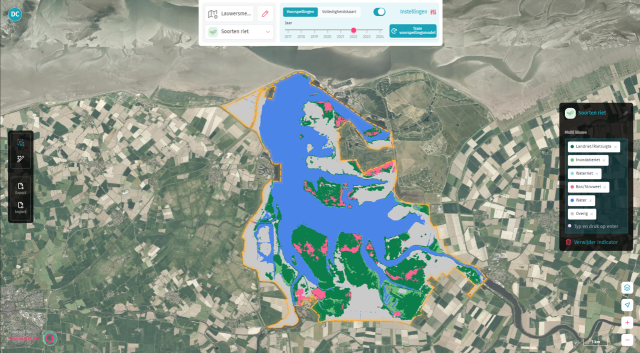
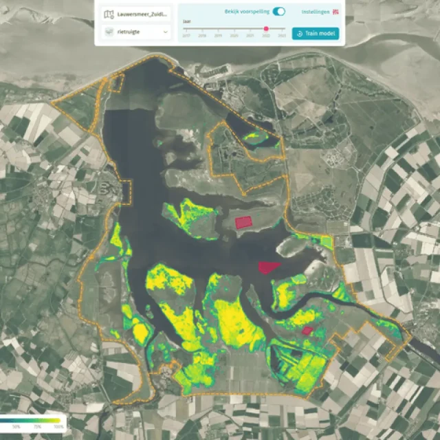
On top of this foundation model, they built Carto: a user-friendly interface that lets users – without any AI knowledge – get started themselves. “You draw a few examples on a map, click ‘train model,’ and within a minute you get results.”
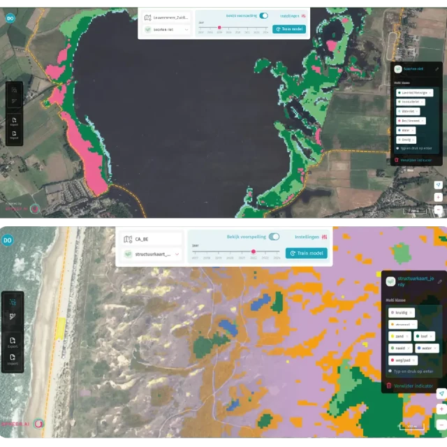
Whether you’re tracking flowering meadows, shifting dunes, or tree dieback, Carto makes powerful AI tools accessible to anyone dealing with spatial questions – and at a speed that was previously unimaginable. “What used to take weeks or months now takes an hour.”
Looking ahead: smarter, easier, faster
The ambitions don’t stop there. Spheer.ai is looking to integrate multiple data types, such as radar, LiDAR, and elevation data, for even sharper and more complete insights.
They’re also working on making the user experience even more intuitive. “The AI shouldn’t just be fast – it should understand what the user means. We want to build toward a smart geo-assistant, a kind of conversation partner that thinks along and gives advice.”
"It should feel like walking into your own kitchen. The dishes should be great, but the kitchen itself shouldn’t be too intimidating."’’
Spheer.ai proves that innovation isn't just about technology, but about accessibility. With Carto, they make AI usable for anyone who wants to better understand and improve the world. To achieve this, they work closely with Sigbar, an experienced SME based in Groningen, known for its deep expertise in user-friendly web interfaces. Sigbar helps translate complex technology into a simple and intuitive user experience. The goal of this collaboration: A deceptively simple platform that users feel at home in right away – and where the results speak louder than the interface.

European funding as a springboard
In the previous phases of Carto’s development, Spheer.ai gained valuable insights. Testing the product with a variety of partners helped accelerate the learning process—and that period now comes to a close as the team carefully transitions into the next phase: exploring the commercialization of the product.
Ultimately, Spheer.ai aims to build a single AI model that can be used for global challenges, without the need for extensive customization. Thanks in part to support from the Just Transition Fund (JTF), Spheer.ai can now “take the next steps in product development with full focus and the entire team behind it,” says Jakko de Jong.
This project is made possible by the Valorisation grant under the European funding program Just Transition Fund (JTF). The JTF, Europe’s fund for a fair climate transition, supports regions most affected by the shift to a green economy. In the Groningen–Emmen region, this program supports the greening of the economy and investment in the jobs of the future.

